
NASA, Norwegian Map Authority to Develop Arctic Satellite Laser Ranging Station
NASA and the Norwegian Mapping Authority are partnering to develop a state-of-the-art satellite laser ranging station 650 miles from the North Pole that will produce high-precision locations of orbiting satellites, help track changes in the ice sheets and improve the efficiency of marine transportation and agriculture.
The Arctic station will be the latest addition to a global network of space geodetic stations, which measure and monitor the size and shape of Earth, its orientation in space, the exact location of points on its surface and how these locations change over time. Space geodesy has a decades-long history at NASA due to its important role in the positioning and navigation of satellites.
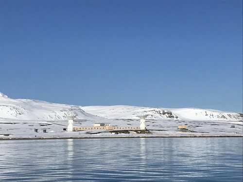
The scientific base of Ny-Ålesund, Svalbard, as seen from the see. The future Satellite Ranging Station will be located between the two antennas visible in the image. Courtesy of Norwegian Mapping Authority/Erik Opseth.
"This partnership with Norway is an important step for NASA and the scientific community in building the next generation space geodetic network," said Benjamin Phillips, program scientist for NASA's Space Geodesy Program in Washington. "This network provides fundamental data for satellite and spacecraft navigation and underpins many of NASA's Earth-observing missions and science."
Under the new agreement, Norway and NASA will build and install a satellite laser ranging facility in the scientific base of Ny-Ålesund, Svalbard. NASA will also provide expert consultation on how to operate the instruments. The ground-based laser transmits ultrashort laser pulses aimed at satellites specially equipped with a retroreflector, an array of special mirrors that bounce the pulses back. The system measures the time it takes for the light to travel back to its point of origin, which is used to determine the position of the satellite with respect to the ground station with an accuracy of about 0.04 in.
Combined with measurements from other geodetic instruments at the Ny-Ålesund Geodetic Observatory and all over the globe, the laser ranging observations will help refine the Global Geodetic Reference Frame, the basis for setting coordinates for all locations on Earth's surface. The reference frame is used to measure the position of objects in space with respect to the Earth, as well as to precisely monitor motions of Earth's crust, changes in sea level, and to support satellite positioning technology like GPS.
"From the NASA perspective, laser ranging is important to understanding where our spacecraft are, as well as where on Earth their measurements are located," said Stephen Merkowitz, space geodesy project manager at NASA's Goddard Space Flight Center in Greenbelt, Maryland. "Laser ranging is needed for satellites that require very precise positioning measurements. Today we're tracking over 90 satellites – not only from NASA, but also from other space agencies – with this technique."
The new Norwegian geodetic station will be the northernmost of its kind and will be invaluable for tracking satellites that follow polar orbits, as many of NASA's Earth-observing missions do.
"In Svalbard, we're already seeing the effects of climate change," said Per Erik Opseth, director of the Geodetic Institute of the Norwegian Mapping Authority in Hønefoss, Norway, the agency working with NASA to develop the new laser ranging system. "Setting up this fundamental station in Ny-Ålesund will help Earth observations from satellites crossing the North Pole, so we can improve our knowledge of ice cap meltdown, sea level rise in this area and also the melt of sea ice in the basin between Russia and North America."
Published: September 2017