Aerial Lidar and Imaging System
GeoQueRequest Info
TRIANA, Ala., Sept. 11, 2025 — 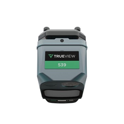 TrueView 539 from GeoCue is for high-quality surveying capabilities for aerial mapping. The lidar range of the system is <300 m for targets with >20% reflectivity. TrueView has a 26-MP global shutter full-frame camera and offers vegetation penetration, accuracy, and consistent results. It uses a CHCNAV single-beam laser scanner, which has a wavelength of 1535 nm. The scanner achieves a precision of 5 mm and an accuracy of 15 mm. The system achieves absolute accuracy from 2 to 5 cm. TrueView 539 includes LP360 drone for processing your lidar data, with optional software add-ons including strip align for drone, photo, and 3D accuracy.
https://geocue.com
/Buyers-Guide/GeoQue/c34654
Published: September 2025
From the Photonics Marketplace
REQUEST INFO ABOUT THIS PRODUCT
* First Name:
* Last Name:
* Email Address:
* Company:
* Country:
Message:
When you click "Send Request", we will record and send your personal contact information to GeoQue by email so they may respond directly. You also agree that Photonics Media may contact you with information related to this inquiry, and that you have read and accept our
Privacy Policy and
Terms and Conditions of Use.
Register or login to auto-populate this form:
Login
Register
* Required