Scanning and Mapping Solution
Inertial Labs Inc.Request Info
PAEONIAN SPRINGS, Va., Aug. 21, 2023 — 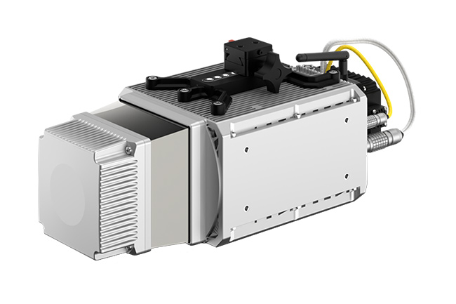 The RESEPI TELEDYNE OPTECH CL-360HD scanning and mapping solution from Inertial Labs Inc. is designed for accuracy-focused remote sensing applications.
The remote sensing payload instrument features the high-performance GPS-aided Inertial Navigation System, combined with a tactical-grade inertial measurement unit, a dual antenna GNSS receiver, and CL-360HD lidar from Teledyne. It offers four-return laser capabilities and a range of up to 750 m, making it suitable for mobile mapping, forestry, and infrastructure applications. The RESEPI platform also includes a Linux-based processing core, data-logging software, a WiFi interface, an optional imaging module, and an external cellular modem for RTCM corrections.
https://inertiallabs.com
/Buyers_Guide/Inertial_Labs_Inc/c32358
Published: August 2023
REQUEST INFO ABOUT THIS PRODUCT
* First Name:
* Last Name:
* Email Address:
* Company:
* Country:
Message:
When you click "Send Request", we will record and send your personal contact information to Inertial Labs Inc. by email so they may respond directly. You also agree that Photonics Media may contact you with information related to this inquiry, and that you have read and accept our
Privacy Policy and
Terms and Conditions of Use.
Register or login to auto-populate this form:
Login
Register
* Required